
Last updated:
Where scanner, camera and drone each meet the project they fit
Key takeaways:
- Laser scanning offers the highest accuracy for as-builts.
- Photogrammetry adds photo-based color and texture.
- Drones extend reach to roofs and large exterior sites.
3D laser scanning, photogrammetry, and drones are often mentioned in the same breath as “reality capture,” and that overlap causes real confusion for owners trying to choose. They are not interchangeable — each captures the world differently, with different strengths, costs, and accuracy. Choosing the wrong one wastes money or produces data you cannot use; choosing the right one gets you exactly the deliverable your project needs.
This guide compares the three approaches in plain terms, explains where each excels, and helps you match the method to your project. In many cases the best answer is a combination.

Laser Scanning: The three methods at a glance
All three produce 3D data, but they work in fundamentally different ways. 3D laser scanning uses a laser to measure millions of precise points directly. Photogrammetry derives 3D geometry by analyzing many overlapping photographs. Drones are not a capture method themselves but a platform — a way to carry a camera or LiDAR sensor aloft to reach areas a tripod or person cannot. Understanding that distinction is the first step to choosing well.
3D laser scanning: precision and reliability
Terrestrial laser scanning is the gold standard for accuracy in existing-conditions capture. It measures distance directly with a laser, achieving documented accuracy of a few millimeters, and it works in any lighting because it does not depend on a camera seeing detail. It captures complex interiors, structural detail, and mechanical systems with exceptional reliability.
Its trade-offs are cost and access. Professional scanners and skilled operators are an investment, and a tripod-based scanner can only reach what it can be set up near. For interiors, as-builts, Scan-to-BIM, and any project where accuracy is non-negotiable, laser scanning is usually the right foundation.
Photogrammetry: visual detail and value
Photogrammetry builds 3D models from overlapping photographs, using software to calculate geometry from the way features shift between images. Its great strengths are rich color and texture and relatively low equipment cost — in good conditions it can produce visually stunning, measurable models from ordinary cameras.
Its limitations are sensitivity to lighting, texture, and conditions. Photogrammetry struggles with blank surfaces, poor light, and reflective materials, and its accuracy is generally lower and more variable than laser scanning. It shines for capturing surfaces, facades, terrain, and objects where visual fidelity matters and millimeter precision is not essential.
Drones: access and scale
Drones solve the access problem. By carrying a camera or a LiDAR sensor, a drone captures rooftops, tall facades, large sites, and dangerous or unreachable areas quickly and safely. Drone photogrammetry is widely used for site mapping, roof inspection, and progress documentation, while drone LiDAR can penetrate vegetation to capture terrain.
The trade-off is that a drone’s data quality depends on its sensor and flight conditions, and regulations govern where and how it can fly. Drones are less about ultimate precision and more about reaching what ground-based methods cannot, at the scale of whole sites and building exteriors.
How to choose — or combine
The right method depends on what you are capturing and why. For accurate interiors, structural and MEP detail, and Scan-to-BIM, laser scanning leads. For textured surfaces, facades, and cost-sensitive visualization, photogrammetry is compelling. For rooftops, large sites, and hard-to-reach exteriors, drones provide access nothing else can.
In practice, the best results often come from combining methods. A project might use terrestrial laser scanning for the building interior and structure, drone capture for the roof and exterior, and photogrammetry for detailed facade texture — then merge everything into one coordinated dataset. A capable reality-capture provider will recommend the mix that delivers the accuracy you need at a sensible cost, rather than forcing every project into a single tool.

Common questions
Which is most accurate?
Terrestrial laser scanning generally provides the highest and most consistent accuracy, typically a few millimeters, which is why it is the standard for existing-conditions documentation.
Is photogrammetry cheaper?
Equipment costs can be lower, but processing time, conditions, and accuracy limits mean the cheapest tool is not always the most economical once you factor in whether the data actually meets your needs.
Can laser scanning, photogrammetry and drones be combined on one project?
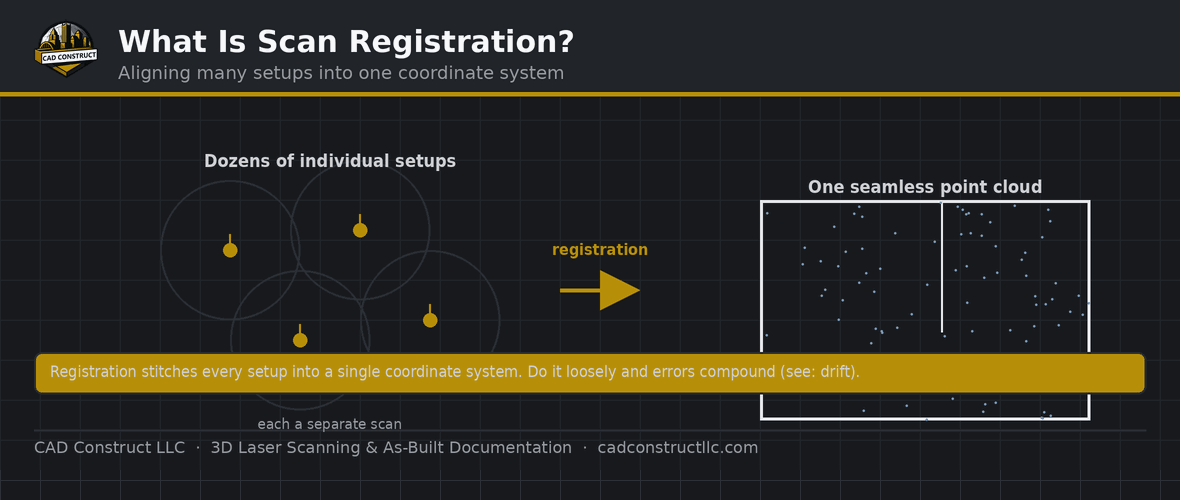
Yes. A common pairing is drone capture for roofs and site context with terrestrial laser scanning for interiors and facades, all registered into one coordinate system.
Do I need a drone for my project?
Only if you need to capture areas that ground-based methods cannot reach safely or efficiently, such as roofs, tall exteriors, or large sites.
Laser scanning, photogrammetry, and drones each capture reality differently, and the smart choice depends on your accuracy needs, your budget, and what you are capturing. Often the strongest deliverable blends more than one.
A decision framework by project type
Matching method to project becomes clearer when you think in terms of outcomes. If you need an accurate interior as-built or a Scan-to-BIM model, start with terrestrial laser scanning. If you are documenting a facade’s texture or a decorative surface for restoration, photogrammetry captures visual detail beautifully. If you must inspect a roof, a tall exterior, or a large site, a drone reaches what ground methods cannot. If your project spans several of these — say, a full building inside and out — a combined capture is almost always the strongest answer.
Cost comparison in practice
Headline equipment costs can be misleading. Photogrammetry appears inexpensive because it can use ordinary cameras, but processing time, sensitivity to conditions, and lower accuracy can make it more expensive once you account for rework or data that falls short. Laser scanning carries a higher equipment and expertise cost but delivers reliable, first-time-right data that reduces downstream risk. Drones add a platform cost and regulatory overhead but save enormous time and expense on access. The most economical choice is the one whose data actually meets your project’s needs without a second attempt.
The accuracy-versus-speed trade-off
Every reality-capture method balances accuracy against speed and coverage. Terrestrial scanning is the most precise but the most deliberate, requiring many setups. Mobile and drone capture cover ground quickly at lower precision. Photogrammetry sits in between, trading conditions and processing for visual richness. Understanding where your project falls on that spectrum — whether you need ultimate precision, maximum coverage, or something in between — is the key to choosing well and not overpaying for precision you will not use or accepting speed at the cost of data you cannot trust.

Why a combined approach often wins
For many commercial and institutional projects, no single method captures everything ideally. The interior demands the precision of laser scanning, the roof and exterior demand the reach of a drone, and detailed surfaces benefit from photogrammetric texture. A provider who can capture with all three and merge them into one coordinated dataset delivers a more complete and more useful result than any single tool could — which is why experienced reality-capture firms think in terms of the right blend rather than a single favorite technology.
How the three methods work together on a real project
Consider a mixed-use commercial building slated for renovation. The design team needs accurate interiors for space planning and MEP coordination, documentation of a detailed masonry facade for restoration, and an assessment of the roof for new equipment. No single method serves all three well. Terrestrial laser scanning captures the interiors and structure at documented accuracy. Photogrammetry records the facade’s texture and ornament in full color for the restoration architects. A drone flies the roof safely, capturing conditions that would otherwise require lifts or climbers. Merged into one coordinated dataset, these captures give every discipline the data it needs in the form it needs it.
This is how experienced reality-capture firms actually work: not by defending one favorite tool, but by assembling the right combination for the project in front of them. The deliverable is judged by whether it answered the project’s questions accurately and economically, not by which technology produced it.
Questions to ask a reality-capture provider
Before hiring, ask a provider which methods they offer and why they would recommend one for your project. Ask what accuracy they expect to deliver, how they verify it, and what the final deliverable will look like in your software. A provider who can explain the trade-offs clearly, and who recommends the method — or blend of methods — that fits your goals rather than the one they happen to own, is the partner most likely to deliver data you can actually use. The right questions up front prevent the far more expensive problem of discovering, after the fact, that the data does not support the decisions you needed to make.
The bottom line for your project
There is no single best reality-capture technology — only the best fit for a given goal, budget, and site. Terrestrial laser scanning wins when accuracy is paramount, photogrammetry when visual detail and cost matter most, and drones when access and scale are the challenge. The most reliable results usually come from a provider who understands all three, recommends the right blend, and delivers one coordinated dataset your whole team can trust. Start by defining what decisions the data must support, and the right method — or combination — becomes clear.
Related guides
Planning a project in the Pittsburgh region? CAD Construct LLC delivers 3D laser scanning, Scan-to-BIM, and virtual tours with field-verified accuracy. Request a scanning quote.


0 Comments