
Connecting millions of measured points to the drawings and models built from them
Last updated:
Key takeaways:
- Millions of measured points capture a space exactly.
- It is the direct output of a 3D laser scan.
- It is the basis for CAD, BIM, and digital twins.
A point cloud is the raw material of nearly every 3D laser scanning project. If you have ever been handed a file full of millions of colored dots that together form a recognizable building, you have already seen one. But understanding what a point cloud actually is — how it is captured, what the numbers behind each point mean, and what you can and cannot do with it — makes the difference between treating scan data as a curiosity and using it as a precise, reliable record of a real structure.
This guide explains point clouds in plain English for building owners, architects, contractors, and facility managers who are new to reality capture. We will cover how point clouds are created, how to read the specifications that come with them, the file formats you are likely to receive, and how the data becomes a CAD drawing or BIM model you can actually build from.

What is a point cloud, exactly?
A point cloud is a large collection of individual measurements — points — that each represent a single location on a physical surface. Every point stores, at minimum, three coordinates: X, Y, and Z. Together those coordinates place the point in three-dimensional space relative to a common origin. When a scanner records millions or billions of these points across the surfaces of a room, a facade, or an entire industrial plant, the accumulated dots form a dense, dimensionally accurate replica of the real thing.
Most modern point clouds carry more than position. Each point typically also stores an intensity value, which describes how strongly the laser pulse reflected off the surface, and in colorized clouds an RGB color value sampled from calibrated photographs taken during the scan. Intensity helps distinguish materials and makes text, signage, and pipe labels legible; color makes the cloud look photographic and easier for non-technical stakeholders to interpret.
Points versus a solid model
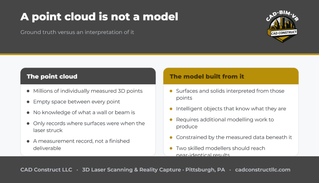
It is important to understand what a point cloud is not. It is not a surface, a solid, or an intelligent model. There is empty space between the points, and the cloud has no knowledge of what a wall or a beam is — it only knows where surfaces were when the laser struck them. That distinction matters because it explains why a point cloud is a measurement record rather than a finished deliverable, and why converting it into usable CAD or BIM requires additional modeling work.
Think of the point cloud as the ground truth and the model as an interpretation of it. Two experienced modelers working from the same cloud should arrive at nearly identical results, because the measured data constrains what the building actually is. That is the core value of laser scanning: it removes guesswork and replaces assumptions with evidence.
How point clouds are captured
Point clouds are produced by reality-capture instruments, most commonly terrestrial laser scanners. A terrestrial scanner sits on a tripod and sweeps a laser across everything in view, measuring the distance to each surface thousands to millions of times per second. Two ranging methods dominate the industry: time-of-flight, which measures how long a pulse takes to travel to a surface and back, and phase-shift, which compares the phase of an emitted and returned continuous wave to derive distance with very high precision at shorter ranges.
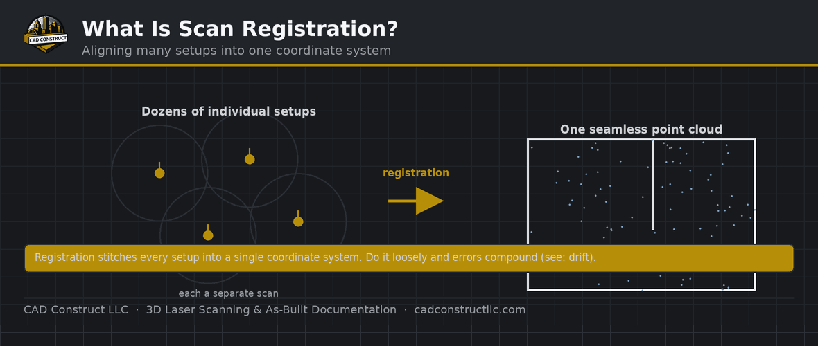
No single scan position can see everything. Furniture, walls, and equipment cast shadows, so a technician moves the scanner to many positions — often dozens for a single building — to capture every surface from multiple angles. Each individual scan produces its own point cloud in its own local coordinate system.
Registration: stitching scans together
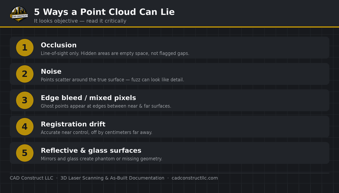
The separate scans are then aligned into one unified cloud through a process called registration. Registration uses overlapping geometry, physical or paper targets, and increasingly cloud-to-cloud algorithms to lock every scan position into a single, consistent coordinate system. Good registration is what keeps the final cloud accurate; poor registration introduces doubling, drift, and error that no amount of downstream modeling can fully correct.
Other ways to capture points
Other capture methods produce point clouds too. Mobile mapping systems mounted on backpacks or vehicles use SLAM to capture large areas quickly at lower precision, aerial and drone LiDAR captures rooftops and sites from above, and photogrammetry derives points from overlapping photographs rather than a laser. Each method trades speed, range, and accuracy differently, but all output the same fundamental product: a cloud of measured points. Choosing the right method is a project-planning decision that balances the accuracy you need against the time and budget available.
Reading point cloud specifications

When you receive scan data, it usually arrives with specifications that describe its quality. Understanding a few key terms helps you judge whether the data fits your project.
- Accuracy describes how closely a measured point matches its true real-world location. Terrestrial scanning achieves accuracy that depends on equipment, control and site conditions, which is more than sufficient for architecture, MEP coordination, and most construction work.
- Resolution or point density describes how closely spaced the points are — for example, one point every 3 mm at a given distance. Higher density captures finer detail but produces larger files and longer processing times.
- Noise refers to small random errors that make a flat surface appear slightly fuzzy. Quality scanners and clean registration keep noise low.
- Registration error reports how well the individual scans align; low, consistent values indicate a trustworthy dataset.
Matching specifications to purpose is key. A structural steel fit-up may demand the tightest tolerances, while a virtual tour or a rough volume estimate can tolerate lower density. Paying for more precision than a project needs wastes money; accepting less than it needs creates rework. A good scanning provider will ask what decisions the data must support before recommending a resolution and accuracy target.

Point cloud file formats you will encounter
Point clouds are stored in several formats, and the right one depends on the software your team uses. Vendor-neutral formats such as E57 and LAS/LAZ are widely interoperable and preferred for archiving and sharing. Autodesk workflows commonly use RCP and RCS files generated by ReCap, which Revit and AutoCAD read natively. Text-based formats like PTS and XYZ are simple and universal but large and slower to load. If you plan to work in a specific platform, confirm the delivery format before the project begins so the data drops straight into your tools without a conversion headache.
From point cloud to usable deliverable

A raw cloud is rarely the end goal. In practice it becomes the accurate foundation for a deliverable your team can work with. The most common paths are Scan-to-BIM, in which modelers trace the cloud to build an intelligent Revit model of walls, structure, and MEP systems, and 2D CAD as-builts, in which the cloud is used to produce dimensioned floor plans, elevations, and sections. The cloud can also be converted into a mesh for visualization, used directly for clash detection and construction verification, or published as a navigable web viewer so stakeholders can measure and explore without specialized software.
Because every one of these deliverables inherits its accuracy from the underlying scan, the quality of the point cloud sets the ceiling for everything built on top of it. That is why professional capture, disciplined registration, and clear specifications matter so much — mistakes made in the field cannot be modeled away later.

Why point clouds matter for owners and design teams
For a building owner, a point cloud is an insurance policy against costly surprises. Renovation and retrofit projects fail budgets when the existing conditions turn out to differ from old drawings; a current, measured cloud eliminates that risk by documenting exactly what is there today. For architects and engineers, designing against scan data means fewer field conflicts, fewer change orders, and prefabricated components that fit on the first try. For facility managers, a point cloud becomes the basis of a digital twin that supports space planning, maintenance, and future capital projects for years to come.
Common questions about point clouds
How big are point cloud files?

They can be very large — a single building can produce tens of gigabytes. Density, colorization, and site size all drive file size, which is why efficient formats and adequate hardware matter for smooth work.
Can I open a point cloud without expensive software?
Yes. Free viewers and web-based deliverables let stakeholders view, navigate, and take basic measurements without buying CAD or BIM licenses, while modeling teams use professional tools to build from the same data.
How long is a point cloud usable?

A point cloud is a snapshot of conditions on the day of the scan. It remains an accurate historical record indefinitely, but if the building changes, a new scan is needed to reflect current conditions.
Is a point cloud the same as a 3D model?
No. A point cloud is measured data; a 3D model is an interpretation built from that data. The cloud is the evidence, and the model is the drawing or BIM your team designs and builds from.
Point clouds turn a physical space into precise, measurable data — the starting point for as-builts, BIM models, digital twins, and virtual tours. Understanding how they are captured and specified helps you commission the right scan the first time and get deliverables you can trust.
Related guides
Planning a project in the Pittsburgh region? CAD Construct LLC delivers 3D laser scanning, Scan-to-BIM, and virtual tours with field-verified accuracy. Request a scanning quote.
Related work: Browse real 3D and BIM models in our BIM portfolio.
Related reading: New to construction drawings? See our guide on how to read construction blueprints, or dive into blueprints vs. 3D models & BIM.


0 Comments