
Last updated:
Connecting your scan to the survey grid civil and site teams use
How state plane coordinate systems tie your scan to real-world survey control for site and civil projects.
Real-world positioning
State plane coordinates place your scan in a recognized survey grid, essential for civil, site, and multi-building work. It builds on georeferencing.
When you need it
Any project combining scans with surveys, GIS, or civil design.
Why coordinate systems matter in scanning
A laser scan captures a site with extraordinary internal accuracy, but a question quickly arises on larger projects: where does this scan sit in the real world? State Plane Coordinates answer that question. They are a standardized system that ties measurements to precise, real-world positions across a region, so that a scan is not just accurate relative to itself but correctly located on the earth. For projects that must align with surveys, other datasets, or regulatory records, referencing the scan to State Plane Coordinates is what makes everything fit together.
Understanding this system helps clients grasp why georeferencing is more than a technical formality — it is what lets scan data integrate with the wider world of project information.
What State Plane Coordinates are
The State Plane Coordinate System divides the country into zones, each with its own carefully defined mathematical projection that flattens a portion of the curved earth onto a plane with minimal distortion. Within a zone, any point can be described by precise coordinates that correspond to its true position on the ground. Because the system is standardized and widely used by surveyors, engineers, and government agencies, it provides a common language of location that everyone working on a project can share, ensuring that separate datasets describe the same reality in the same terms.
Local coordinates versus real-world coordinates
Left to itself, a scan lives in its own local coordinate system, accurate internally but arbitrary in its placement — its origin is wherever the scanning happened to start. That is perfectly fine for many standalone tasks. But when a scan must combine with a boundary survey, a civil design, aerial data, or another building’s model, those local coordinates are not enough. Georeferencing transforms the scan into real-world coordinates so it lands in its true position, allowing it to align seamlessly with any other correctly referenced dataset.

How a scan gets georeferenced
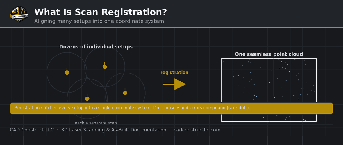
Tying a scan to State Plane Coordinates involves establishing known control points whose real-world positions have been determined by survey. During or after scanning, these control points link the scan data to the coordinate system, so the entire point cloud is positioned and oriented correctly in the real world. The quality of that control directly affects the accuracy of the georeferencing, which is why coordinating with survey control is an important part of projects that demand real-world positioning. Done properly, the scan inherits the accuracy of the survey that anchors it.
Integrating with survey and civil data
The clearest benefit of georeferenced scans appears when they meet civil and survey data. Site surveys, property boundaries, utility records, and civil designs are typically expressed in State Plane Coordinates, so a scan referenced to the same system drops directly into that context. A building scan can be positioned accurately on its surveyed site, existing conditions can be checked against property lines, and interior and exterior datasets can be combined without manual alignment. This integration is essential for projects that span the boundary between building and site.
Combining multiple scans and datasets
Large or phased projects often involve multiple scans captured at different times or by different teams, along with data from other sources. When every dataset is referenced to the same coordinate system, they all combine automatically into one coherent whole. There is no painstaking manual fitting of one scan to another — shared coordinates guarantee they line up. This is invaluable for campuses, corridors, and projects that unfold over time, where a consistent coordinate basis keeps a growing body of data unified and trustworthy.
Managing distortion and scale
Because State Plane projections flatten a curved earth, they introduce small, well-understood scale differences between grid coordinates and true ground distances. For most building-scale work this is negligible, but on large sites it can matter, and professionals account for it deliberately. Understanding whether a project works in grid or ground coordinates, and handling the relationship between them correctly, ensures that measurements remain consistent across the whole dataset. Awareness of this subtlety is part of what separates a properly georeferenced deliverable from one that quietly accumulates error over distance.

When georeferencing is essential and when it is not
Not every scan needs to be tied to State Plane Coordinates. A standalone interior renovation may never touch survey data and can work perfectly well in local coordinates. But any project that must integrate with site surveys, civil design, regulatory submissions, or other georeferenced information needs real-world coordinates to function. Deciding up front whether a project requires georeferencing — and to what accuracy — ensures the scan is set up correctly from the start rather than needing costly rework to add coordinates later.
How CAD Construct handles coordinates
CAD Construct georeferences scans to State Plane Coordinates when a project calls for it, coordinating with survey control so that existing-conditions data aligns accurately with surveys, civil design, and other datasets. For clients across the Pittsburgh region, that means scan deliverables that fit correctly into the real world — ready to combine with site data, support integrated design, and serve any workflow where true position matters.
Choosing the right zone and datum
Applying State Plane Coordinates correctly means working in the proper zone and on the correct datum — the reference framework that defines how coordinates relate to the earth. Using the wrong zone or an outdated datum introduces errors that can be surprisingly large and easy to overlook. Because datums are periodically updated, it also matters that a project’s scan data and its other datasets share the same reference framework. Confirming these details before work begins prevents the frustrating situation where two accurate datasets refuse to line up because they were built on different foundations.
Elevation and vertical reference
Horizontal position is only part of the picture; many projects also need accurate elevation. Vertical data is referenced to its own framework, and tying a scan’s heights to the correct vertical reference is just as important as its horizontal coordinates for work involving grading, drainage, floodplains, or multi-level coordination. A fully georeferenced scan positions the site correctly in all three dimensions, so that floor elevations, site grades, and vertical clearances all relate properly to the real world and to any survey or civil data they must match.
Coordinating with surveyors early
The smoothest georeferenced projects are the ones where the scanning team and the surveyors coordinate from the outset. Agreeing on the coordinate system, the control points, and the accuracy requirements before scanning begins ensures the data comes together cleanly. When this coordination is left until after capture, aligning the scan to survey control can become a corrective exercise rather than a built-in feature. Early collaboration means the scan is anchored to reliable control as it is collected, delivering real-world accuracy without the need for later adjustment.

Georeferencing for long-term value
A georeferenced scan holds its value far into the future. Because it is tied to a standard coordinate system, it can be revisited years later and combined with new surveys, new scans, or new design data without any guesswork about how it relates to the world. This makes georeferencing an investment in the longevity of the data, ensuring that a capture made today remains a useful, integrable reference for future phases, renovations, or expansions rather than an isolated dataset that must be painstakingly re-aligned each time it is needed.
Supporting regulatory and permitting needs
Many regulatory submissions, permits, and official records are expressed in real-world coordinates, and a georeferenced scan meets them on their own terms. Whether documenting a site for permitting, demonstrating compliance with setback or floodplain requirements, or contributing to official records, scan data tied to State Plane Coordinates integrates directly with the systems authorities use. This alignment smooths approvals and reduces the friction of translating between a project’s data and the regulatory framework it must satisfy, because both are speaking the same coordinate language.
Accuracy that carries across the project
The ultimate reason to georeference is consistency of accuracy across everything a project touches. When the scan, the survey, the civil design, and every other dataset share a common, correct coordinate basis, accuracy is preserved as data moves between teams and tools. Nothing drifts, nothing has to be manually forced into place, and every party can trust that a given coordinate means the same location to everyone. That shared, reliable frame of reference is the quiet foundation on which integrated, error-free project data depends.
Getting it right from the start
Coordinate decisions are far cheaper to make correctly at the beginning than to fix later. Establishing the right system, datum, control, and accuracy targets before scanning ensures the deliverable arrives ready to integrate, with no costly reprocessing to add or correct coordinates after the fact. An experienced scanning partner raises these questions early precisely because getting them right up front is what allows the finished data to slot seamlessly into the wider world of survey, civil, and regulatory information a project depends on.
Related reading
3D Laser Scanning vs. Photogrammetry vs. Drones: Which Is Right for Your Project?
Point Cloud File Formats Explained: RCP, E57, LAS, PTS and More
What Is a Point Cloud? A Beginner’s Guide
· Laser Scanning vs. Total Station Surveying
FAQ
Do all projects need this? Only when tying to real-world control or other datasets.
Can you match our datum? Yes — we register to your control and datum.
Get field-verified existing conditions in Pittsburgh
CAD Construct LLC delivers 3D laser scanning, as-built drawings, scan-to-BIM, and 360° virtual tours across Pittsburgh & Western PA. Request a free quote or call (800) 967-2627.



0 Comments