
Last updated:
Linking timed laser pulses to the point cloud behind every scan
Key takeaways:
- LiDAR times laser pulses to measure distance precisely.
- It produces dense 3D point clouds of real spaces.
- Powers terrestrial scanning, aerial mapping, and mobile capture.
LiDAR measures distance with laser light to build precise 3D data — the technology behind 3D laser scanning.
LiDAR stands for Light Detection and Ranging, and the plain-English version is simple: it measures distance with laser light. The device fires rapid pulses of laser, times how long each one takes to bounce back, and converts that into a precise distance. Do this hundreds of thousands of times a second while sweeping across a scene, and you build a dense 3D map of everything the laser touched — a point cloud.
It is the technology behind 3D laser scanning, self-driving car sensors, drone terrain mapping, and the room-scanning features in some phones and tablets. Here is how it works and why it has become such a workhorse for capturing the built world.
How LiDAR works
At its heart, LiDAR is about timing light. The sensor emits a laser pulse, and because the speed of light is known, the time it takes for that pulse to reflect off a surface and return tells the device exactly how far away the surface is. This is called time-of-flight measurement. Some scanners instead use a phase-based method, comparing the phase of the returning light to the emitted beam for very high precision at shorter ranges.
A spinning or oscillating mirror sweeps the beam across the scene, and the sensor records the distance and angle of every return. Combine millions of these measurements and you get a cloud of 3D points, each with an X, Y, and Z position. Many systems also record the intensity of each return — how much light came back — which adds surface information and helps distinguish materials.
The result is an accurate, measurable 3D representation of the real world, captured far faster than any manual survey could manage.
LiDAR (Light Detection and Ranging) fires laser pulses and times their return to measure distance, building millions of precise 3D points. It is the engine inside 3D laser scanning.
LiDAR vs. photogrammetry
LiDAR is often compared to photogrammetry, which reconstructs 3D geometry from overlapping photographs rather than laser measurements. Both produce point clouds, but they have different strengths. LiDAR measures distance directly, so it performs well in low light, sees through gaps in vegetation, and delivers reliable accuracy on plain or featureless surfaces. Photogrammetry depends on good lighting and visual texture but captures rich color and can be very cost-effective with just a camera or drone.
In practice, the two are complementary. Many projects use LiDAR for precise geometry and photogrammetry for color and context, and modern scanners often pair a laser with cameras to deliver both at once. The right choice depends on the site, the lighting, the accuracy required, and whether color is essential.
LiDAR measures directly and works in any light; photogrammetry infers 3D from photos. Compare the methods.
Types of LiDAR
LiDAR comes in several forms defined by how the sensor is deployed. Terrestrial LiDAR sits on a tripod for high-accuracy building and site capture. Mobile LiDAR mounts on a vehicle or backpack to cover roads, campuses, and large areas quickly. Airborne LiDAR flies on aircraft or drones to map terrain, forests, and infrastructure from above. Each targets a different scale and accuracy, but all share the same underlying principle of measuring distance with laser pulses.

What LiDAR is used for
The technology reaches far beyond construction. In AEC it captures existing conditions for renovation, coordination, and as-built documentation. Surveyors use it for topographic mapping; autonomous vehicles use it to perceive their surroundings in real time; foresters use airborne LiDAR to measure canopy and terrain; and archaeologists use it to reveal features hidden under vegetation. Anywhere accurate 3D measurement of the physical world is valuable, LiDAR tends to show up.
How accurate is LiDAR?
Accuracy depends on the type of system and the conditions. High-end terrestrial scanners reach a few millimeters, mobile systems typically achieve centimeter-level results, and airborne LiDAR is measured in centimeters to decimeters over large areas. Range, surface material, and — for mobile and airborne systems — the quality of GNSS positioning all affect the outcome. As with any survey technology, the real-world accuracy of a project depends as much on method and processing as on the sensor’s headline specification.
From LiDAR to a usable model
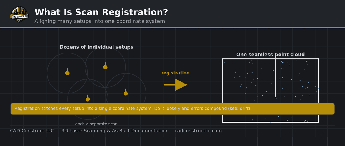
A raw LiDAR scan is a point cloud, not a finished drawing or model. Turning it into something useful involves registering multiple scans into one dataset, cleaning out noise, and then modeling or drafting from the data in software like Revit or AutoCAD. This is the scan-to-BIM pipeline, and it is where raw measurements become as-built models, floor plans, sections, and coordinated design information that teams can actually build from.

Advantages of LiDAR capture
- Speed — millions of measurements per second, capturing spaces in minutes that would take days to measure by hand.
- Accuracy — reliable, repeatable measurements suitable for design and construction.
- Completeness — it records everything in view, so questions can be answered later without a return visit.
- Safety — hazardous or hard-to-reach areas can be documented from a distance.
- Works in low light — because it supplies its own laser, LiDAR does not depend on ambient lighting.
A brief history of LiDAR
LiDAR emerged in the 1960s, not long after the invention of the laser, and was used early on for meteorology and, famously, to measure the distance to the Moon during the Apollo program. As lasers, GPS, and computing improved, it moved into airborne terrain mapping, then into the compact terrestrial scanners used in surveying and construction today. The most recent chapter is miniaturization: solid-state sensors small and cheap enough to sit in cars and consumer tablets, putting a technology once reserved for specialists into everyday devices.

LiDAR in phones and everyday devices
Some recent phones and tablets include small LiDAR sensors used for augmented reality, quick room measurement, and better photography in low light. These consumer sensors are convenient and genuinely useful for rough capture, but they are not a substitute for scanning. Their range and accuracy are limited, so while they are great for a quick sketch of a room, professional as-built work still relies on dedicated terrestrial, mobile, or airborne systems.
Choosing LiDAR for your project
If your goal is accurate documentation of a building, site, or piece of infrastructure, LiDAR-based laser scanning is usually the right tool. The main decisions are which deployment fits — terrestrial for precision, mobile for large areas, airborne for terrain — and what final deliverable you need from the resulting point cloud. A capable provider will match the system to your accuracy and coverage requirements rather than applying one approach to every job.
The takeaway on LiDAR
LiDAR turns laser light into precise 3D measurement, and that simple idea underpins everything from self-driving cars to the as-built models used to renovate buildings. For construction and design, it means an existing space can be documented quickly, accurately, and completely, giving teams a reliable digital record to work from. Whatever the deployment, the output is the same trustworthy point cloud — the raw material for models, drawings, and decisions.
Related reading
Point Cloud File Formats Explained: RCP, E57, LAS, PTS and More
What Is a Point Cloud? A Beginner’s Guide
FAQ
Is LiDAR the same as laser scanning? Laser scanning uses LiDAR to capture buildings and sites.
Does LiDAR need light? No — it provides its own laser and works in the dark.
What does LiDAR stand for?
Light Detection and Ranging. It measures distance by timing laser pulses that reflect off surfaces.
Is LiDAR the same as 3D laser scanning?
3D laser scanning is LiDAR applied to capturing objects, buildings, and sites. LiDAR is the underlying measurement technology; laser scanning is one of its most common uses.
Does LiDAR work in the dark?
Yes. Because it emits its own laser light, LiDAR does not rely on ambient lighting and can capture in darkness — one of its advantages over photography-based methods.
LiDAR or photogrammetry — which is better?
Neither universally. LiDAR excels at direct, accurate geometry and low-light performance; photogrammetry captures rich color cost-effectively. Many projects combine both.
What do I get from a LiDAR scan?
A point cloud, which can then be processed into as-built models, floor plans, sections, meshes, or virtual tours depending on your needs.
Is LiDAR safe?
Yes. The lasers used in surveying and scanning are low-power and eye-safe under normal use, which is why the technology is deployed routinely in occupied buildings and public spaces.
How fast can LiDAR capture a space?
Very fast — modern scanners record hundreds of thousands to millions of points per second, documenting a room in minutes and a whole building in a day or less depending on size and detail.
Can LiDAR see through walls?
No. LiDAR measures surfaces the laser can reach; it cannot see through solid objects. It can, however, capture through gaps such as vegetation, which is why airborne LiDAR is used to map the ground beneath tree cover.
Get field-verified existing conditions in Pittsburgh
CAD Construct LLC delivers 3D laser scanning, as-built drawings, scan-to-BIM, and 360° virtual tours across Pittsburgh & Western PA. Request a free quote or call (800) 967-2627.


0 Comments